



Routes
Czarnków-Trzcianka County/ Greater Poland Voivodeship
Showing 24 routes

96% Offroad score
Difficult
59m Highest peak
Stobno - Piła humm
Offroad score96%
No known restrictions94%
Distance25.27 km
Highest peak59m
Offroad24.27 km
1 year ago
View route
91% Offroad score
Difficult
114m Highest peak
Skrzetusz - Sobolewo
Offroad score91%
No known restrictions99%
Distance12.65 km
Highest peak114m
Offroad11.45 km
2 years ago
View route
57% Offroad score
Moderate
56m Highest peak
Netze
Offroad score57%
No known restrictions90%
Distance24.31 km
Highest peak56m
Offroad13.92 km
1 year ago
View route
50% Offroad score
Moderate
107m Highest peak
Chodzież - Biała
Offroad score50%
No known restrictions92%
Distance37.45 km
Highest peak107m
Offroad18.69 km
3 years ago
View route
100% Offroad score
Difficult
53m Highest peak
Stobno - Radolin
Offroad score100%
No known restrictions93%
Distance10.95 km
Highest peak53m
Offroad10.95 km
2 years ago
View route
40% Offroad score
Moderate
79m Highest peak
Wronki - Mialy
Offroad score40%
No known restrictions95%
Distance41.61 km
Highest peak79m
Offroad16.54 km
2 years ago
View route
73% Offroad score
Difficult
112m Highest peak
Oborniki Czarnkow
Offroad score73%
No known restrictions74%
Distance65.88 km
Highest peak112m
Offroad47.97 km
8 months ago
View route
65% Offroad score
Moderate
206m Highest peak
Polskie szlajanie 4x4
Offroad score65%
No known restrictions85%
Distance63.14 km
Highest peak206m
Offroad41.12 km
3 years ago
View route
50% Offroad score
Moderate
83m Highest peak
Śmiłowo - Klempicz
Offroad score50%
No known restrictions82%
Distance40.31 km
Highest peak83m
Offroad20.27 km
1 year ago
View route
67% Offroad score
Moderate
64m Highest peak
Wronki
Offroad score67%
No known restrictions76%
Distance42.84 km
Highest peak64m
Offroad28.61 km
3 years ago
View route
46% Offroad score
Moderate
96m Highest peak
Popowo - Osów
Offroad score46%
No known restrictions73%
Distance44.52 km
Highest peak96m
Offroad20.46 km
3 years ago
View route
96% Offroad score
Difficult
126m Highest peak
Stobno - Niekursko
Offroad score96%
No known restrictions27%
Distance18.19 km
Highest peak126m
Offroad17.5 km
1 year ago
View route
55% Offroad score
Moderate
112m Highest peak
Miękowo - Połajewo 28.01
Offroad score55%
No known restrictions81%
Distance65.95 km
Highest peak112m
Offroad36.59 km
2 years ago
View route
64% Offroad score
Moderate
134m Highest peak
Tulipany
Offroad score64%
No known restrictions85%
Distance90.36 km
Highest peak134m
Offroad57.86 km
1 year ago
View route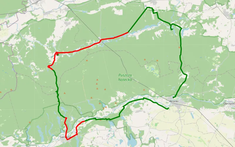
50% Offroad score
Moderate
60m Highest peak
Wronki
Offroad score50%
No known restrictions81%
Distance58.58 km
Highest peak60m
Offroad29.03 km
3 years ago
View route
55% Offroad score
Moderate
69m Highest peak
MaryLin - Sarbinowo
Offroad score55%
No known restrictions58%
Distance38.56 km
Highest peak69m
Offroad21.35 km
2 years ago
View route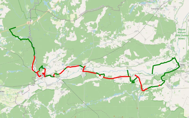
45% Offroad score
Moderate
89m Highest peak
Czarnków - Nowe Dwory
Offroad score45%
No known restrictions81%
Distance78.35 km
Highest peak89m
Offroad35.64 km
1 year ago
View route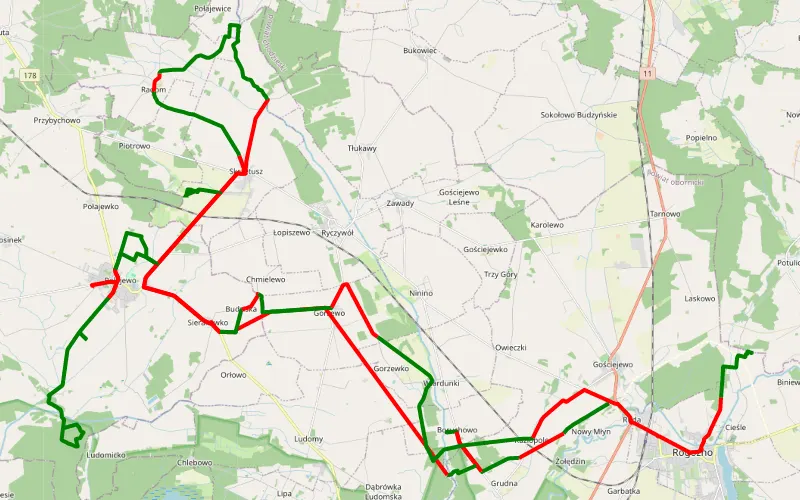
52% Offroad score
Moderate
93m Highest peak
Rogozno
Offroad score52%
No known restrictions94%
Distance95.89 km
Highest peak93m
Offroad49.4 km
1 year ago
View route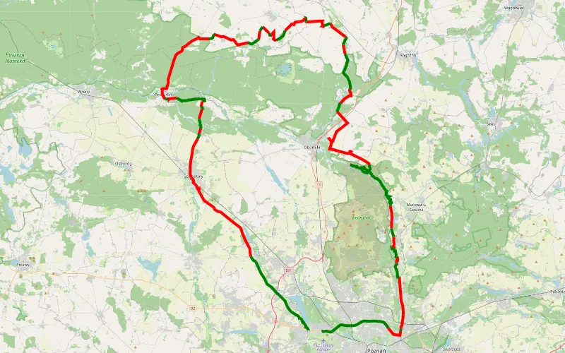
34% Offroad score
Easy
99m Highest peak
Trasa 2. Listopadowe szwendanie
Offroad score34%
No known restrictions84%
Distance130.98 km
Highest peak99m
Offroad44.65 km
11 months ago
View route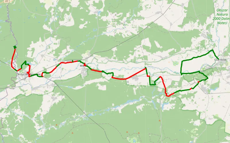
49% Offroad score
Moderate
112m Highest peak
Czarnków - Przeborowo
Offroad score49%
No known restrictions89%
Distance66.73 km
Highest peak112m
Offroad32.92 km
4 years ago
View route
100% Offroad score
Difficult
87m Highest peak
Białla - Wronki
Offroad score100%
No known restrictions38%
Distance13.69 km
Highest peak87m
Offroad13.69 km
1 year ago
View route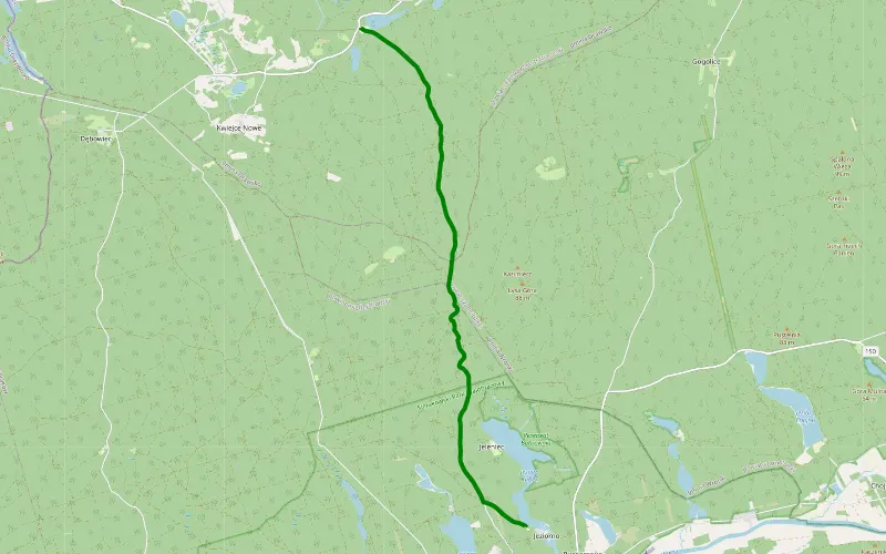
100% Offroad score
Difficult
74m Highest peak
Bucharzewo - Borzysko
Offroad score100%
No known restrictions90%
Distance9.98 km
Highest peak74m
Offroad9.98 km
5 years ago
View route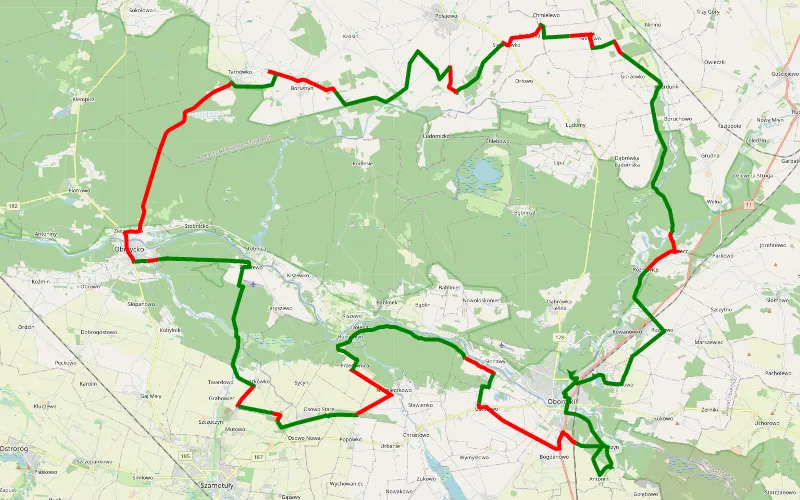
61% Offroad score
Moderate
89m Highest peak
Gołaszyn
Offroad score61%
No known restrictions87%
Distance93.65 km
Highest peak89m
Offroad57.58 km
3 years ago
View route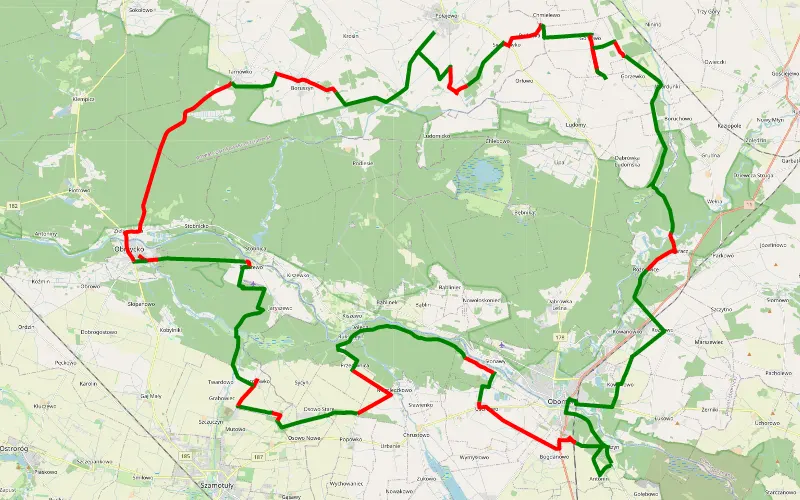
62% Offroad score
Moderate
94m Highest peak
Gołaszyn
Offroad score62%
No known restrictions84%
Distance101.03 km
Highest peak94m
Offroad62.27 km
2 years ago
View route