



Routes
Cieszyn County/ Silesian Voivodeship
Showing 24 routes

68% Offroad score
Moderate
901m Highest peak
Soszów Wielki and Cieślar from Wisła
Offroad score68%
No known restrictions95%
Distance10.21 km
Highest peak901m
Offroad6.94 km
4 months ago
View route
100% Offroad score
Difficult
925m Highest peak
Cyrla - Jezioro Czerniańskie - Czarne
Offroad score100%
No known restrictions96%
Distance5.22 km
Highest peak925m
Offroad5.22 km
2 months ago
View route
52% Offroad score
Moderate
933m Highest peak
Malinka - Salmopol
Offroad score52%
No known restrictions89%
Distance41.38 km
Highest peak933m
Offroad21.58 km
4 months ago
View route
74% Offroad score
Difficult
908m Highest peak
Brenna zbychu i jaworowa
Offroad score74%
No known restrictions98%
Distance25.34 km
Highest peak908m
Offroad18.85 km
1 year ago
View route
59% Offroad score
Moderate
828m Highest peak
Czarne - Wisła
Offroad score59%
No known restrictions99%
Distance27.41 km
Highest peak828m
Offroad16.23 km
2 years ago
View route
100% Offroad score
Difficult
803m Highest peak
Fajna kamienie znośne
Offroad score100%
No known restrictions86%
Distance6.62 km
Highest peak803m
Offroad6.62 km
1 year ago
View route
100% Offroad score
Difficult
909m Highest peak
Hala Jaworowa
Offroad score100%
No known restrictions99%
Distance6.19 km
Highest peak909m
Offroad6.19 km
1 year ago
View route
86% Offroad score
Difficult
803m Highest peak
Wisła - Krzywonik
Offroad score86%
No known restrictions76%
Distance10.34 km
Highest peak803m
Offroad8.93 km
5 months ago
View route
100% Offroad score
Difficult
690m Highest peak
Wisła tor - Pod piramidą
Offroad score100%
No known restrictions99%
Distance7.24 km
Highest peak690m
Offroad7.24 km
3 years ago
View route
55% Offroad score
Moderate
861m Highest peak
Czarne - Głebce
Offroad score55%
No known restrictions99%
Distance18.85 km
Highest peak861m
Offroad10.37 km
1 year ago
View route
100% Offroad score
Difficult
728m Highest peak
Jawornik - Wisła
Offroad score100%
No known restrictions99%
Distance4.8 km
Highest peak728m
Offroad4.8 km
1 year ago
View route
28% Offroad score
Easy
288m Highest peak
Kończyce Wielkie - Gilowice
Offroad score28%
No known restrictions99%
Distance41.29 km
Highest peak288m
Offroad11.57 km
10 months ago
View route
26% Offroad score
Easy
548m Highest peak
Wilamowice - Leszna Górna
Offroad score26%
No known restrictions99%
Distance35.67 km
Highest peak548m
Offroad9.37 km
1 year ago
View route
78% Offroad score
Difficult
870m Highest peak
Katarzynka - Soszów Wielki - Wisła
Offroad score78%
No known restrictions86%
Distance12.01 km
Highest peak870m
Offroad9.34 km
2 years ago
View route
100% Offroad score
Difficult
805m Highest peak
Wisła - Kępkowa
Offroad score100%
No known restrictions68%
Distance8.89 km
Highest peak805m
Offroad8.89 km
7 months ago
View route
100% Offroad score
Difficult
808m Highest peak
Tokarnia - Ślizówka
Offroad score100%
No known restrictions61%
Distance8.95 km
Highest peak808m
Offroad8.95 km
1 year ago
View route
100% Offroad score
Difficult
808m Highest peak
Lajtowa traska po górach z widokami
Offroad score100%
No known restrictions68%
Distance9.47 km
Highest peak808m
Offroad9.47 km
2 years ago
View route
100% Offroad score
Difficult
794m Highest peak
Wisła - Kępkowa
Offroad score100%
No known restrictions82%
Distance5.06 km
Highest peak794m
Offroad5.06 km
1 year ago
View route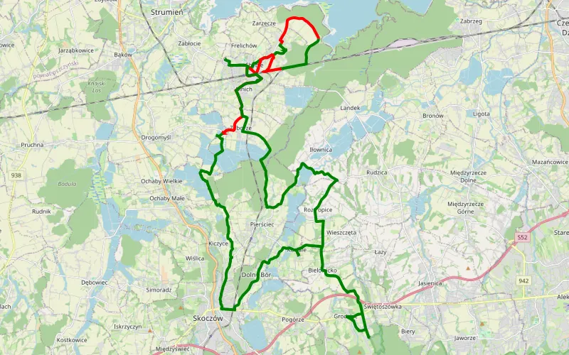
23% Offroad score
Easy
383m Highest peak
Mnich
Offroad score23%
No known restrictions91%
Distance14.31 km
Highest peak383m
Offroad3.31 km
1 month ago
View route
93% Offroad score
Difficult
1046m Highest peak
Krzywonik - Stary Groń - Kotarz - Walczakula
Offroad score93%
No known restrictions18%
Distance20.79 km
Highest peak1,046m
Offroad19.27 km
9 months ago
View route
22% Offroad score
Easy
565m Highest peak
Łączka - Ustroń
Offroad score22%
No known restrictions94%
Distance32.81 km
Highest peak565m
Offroad7.19 km
6 months ago
View route
93% Offroad score
Difficult
987m Highest peak
Bielsko
Offroad score93%
No known restrictions64%
Distance15.12 km
Highest peak987m
Offroad14.13 km
2 years ago
View route
24% Offroad score
Easy
543m Highest peak
Skoczów - Cisownica
Offroad score24%
No known restrictions99%
Distance34.13 km
Highest peak543m
Offroad8.09 km
3 years ago
View route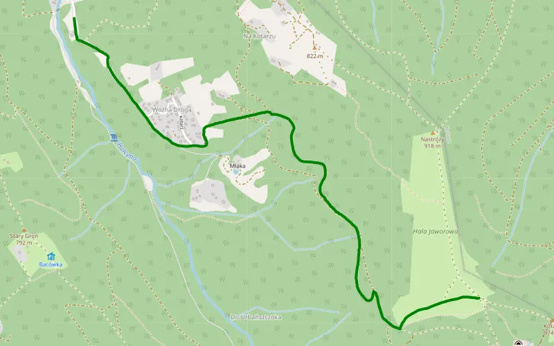
100% Offroad score
Difficult
890m Highest peak
Jaworowa
Offroad score100%
No known restrictions99%
Distance2.54 km
Highest peak890m
Offroad2.54 km
3 months ago
View route