



Routes
Strzelce County/ Opole Voivodeship
Showing 18 routes
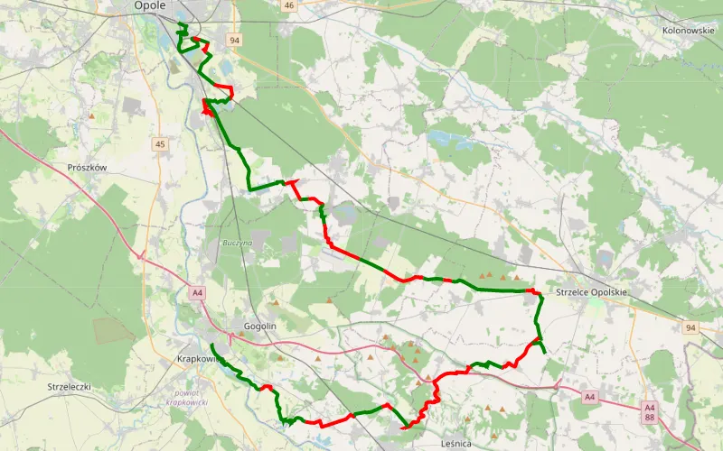
57% Offroad score
Moderate
378m Highest peak
Nowa Wieś Królewska - Otmęt
Offroad score57%
No known restrictions88%
Distance77.95 km
Highest peak378m
Offroad44.65 km
29 days ago
View route
84% Offroad score
Difficult
180m Highest peak
Szczepanowice - Tarnów Opolski
Offroad score84%
No known restrictions92%
Distance15.57 km
Highest peak180m
Offroad13.06 km
3 years ago
View route
60% Offroad score
Moderate
291m Highest peak
Sarnów - Kotulin
Offroad score60%
No known restrictions99%
Distance19.02 km
Highest peak291m
Offroad11.46 km
1 year ago
View route
60% Offroad score
Moderate
293m Highest peak
Sieroty - Płużnica Wielka
Offroad score60%
No known restrictions87%
Distance19.44 km
Highest peak293m
Offroad11.57 km
7 months ago
View route
81% Offroad score
Difficult
196m Highest peak
Nakło
Offroad score81%
No known restrictions88%
Distance12.95 km
Highest peak196m
Offroad10.42 km
3 years ago
View route
58% Offroad score
Moderate
388m Highest peak
Góra Świętej Anny - Żyrowa
Offroad score58%
No known restrictions59%
Distance10.94 km
Highest peak388m
Offroad6.33 km
1 month ago
View route
29% Offroad score
Easy
283m Highest peak
Pologne J7 Kurowskie Chałupy - Dąbrówka
Offroad score29%
No known restrictions91%
Distance156.76 km
Highest peak283m
Offroad44.73 km
2 months ago
View route
55% Offroad score
Moderate
391m Highest peak
Góra Świętej Anny - Leśnica
Offroad score55%
No known restrictions80%
Distance14.23 km
Highest peak391m
Offroad7.87 km
4 years ago
View route
25% Offroad score
Easy
391m Highest peak
TET PL-03 20220823
Offroad score25%
No known restrictions95%
Distance754.9 km
Highest peak391m
Offroad191.22 km
3 years ago
View route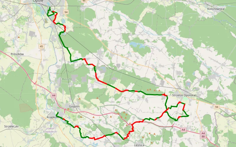
59% Offroad score
Moderate
383m Highest peak
Winów → Kaplica św. Floriana w Rożniątowie
Offroad score59%
No known restrictions85%
Distance84.42 km
Highest peak383m
Offroad50.03 km
1 month ago
View route
100% Offroad score
Difficult
288m Highest peak
Zalesie Śląskie - Leśnica
Offroad score100%
No known restrictions87%
Distance1.58 km
Highest peak288m
Offroad1.58 km
4 years ago
View route
40% Offroad score
Moderate
363m Highest peak
Poręba - Turawa
Offroad score40%
No known restrictions77%
Distance106.59 km
Highest peak363m
Offroad42.58 km
8 years ago
View route
73% Offroad score
Difficult
282m Highest peak
Bycina Zawadzkie
Offroad score73%
No known restrictions62%
Distance41.71 km
Highest peak282m
Offroad30.52 km
7 years ago
View route
81% Offroad score
Difficult
209m Highest peak
Bk
Offroad score81%
No known restrictions36%
Distance14.38 km
Highest peak209m
Offroad11.72 km
6 years ago
View route
58% Offroad score
Moderate
330m Highest peak
Sieroty - Paczynka
Offroad score58%
No known restrictions87%
Distance52.93 km
Highest peak330m
Offroad30.61 km
6 years ago
View route
65% Offroad score
Moderate
205m Highest peak
Włóczęga trasa 2
Offroad score65%
No known restrictions79%
Distance53.64 km
Highest peak205m
Offroad35.13 km
6 years ago
View route
65% Offroad score
Moderate
220m Highest peak
Włóczęga 2019
Offroad score65%
No known restrictions80%
Distance60.57 km
Highest peak220m
Offroad39.31 km
6 years ago
View route
38% Offroad score
Easy
261m Highest peak
Dębicz - Brzeźnica
Offroad score38%
No known restrictions85%
Distance73.98 km
Highest peak261m
Offroad27.99 km
6 years ago
View route