



Routes
Brzesko County/ Lesser Poland Voivodeship
Showing 24 routes

100% Offroad score
Difficult
352m Highest peak
Poręba Spytkowska - Okocim
Offroad score100%
No known restrictions96%
Distance6.91 km
Highest peak352m
Offroad6.91 km
1 year ago
View route
57% Offroad score
Moderate
505m Highest peak
Lasy w Iwkowej
Offroad score57%
No known restrictions90%
Distance15.87 km
Highest peak505m
Offroad9.03 km
1 year ago
View route
92% Offroad score
Difficult
509m Highest peak
Lipnica Dolna - Tymowa
Offroad score92%
No known restrictions87%
Distance8.12 km
Highest peak509m
Offroad7.47 km
4 years ago
View route
100% Offroad score
Difficult
368m Highest peak
Cuz
Offroad score100%
No known restrictions99%
Distance4.23 km
Highest peak368m
Offroad4.23 km
11 months ago
View route
100% Offroad score
Difficult
356m Highest peak
Rto cmentarz Poręba do Jasień wosnicka
Offroad score100%
No known restrictions99%
Distance3.76 km
Highest peak356m
Offroad3.76 km
1 year ago
View route
86% Offroad score
Difficult
436m Highest peak
Ruda Kameralna
Offroad score86%
No known restrictions90%
Distance6.18 km
Highest peak436m
Offroad5.31 km
4 years ago
View route
100% Offroad score
Difficult
425m Highest peak
Zawada Lanckorońska - Ruda Kameralna
Offroad score100%
No known restrictions85%
Distance7.66 km
Highest peak425m
Offroad7.66 km
4 years ago
View route
55% Offroad score
Moderate
371m Highest peak
Ruda
Offroad score55%
No known restrictions99%
Distance5.17 km
Highest peak371m
Offroad2.87 km
4 years ago
View route
53% Offroad score
Moderate
352m Highest peak
Poręba koło cmentarza -jasien wisnicka
Offroad score53%
No known restrictions99%
Distance4.62 km
Highest peak352m
Offroad2.46 km
1 year ago
View route
56% Offroad score
Moderate
208m Highest peak
Załetownia - Rudy
Offroad score56%
No known restrictions99%
Distance12.4 km
Highest peak208m
Offroad6.92 km
4 years ago
View route
100% Offroad score
Difficult
365m Highest peak
Piaski Drużków
Offroad score100%
No known restrictions99%
Distance2.75 km
Highest peak365m
Offroad2.75 km
1 year ago
View route
60% Offroad score
Moderate
349m Highest peak
Łazy - Jasień
Offroad score60%
No known restrictions99%
Distance6.14 km
Highest peak349m
Offroad3.69 km
4 years ago
View route
100% Offroad score
Difficult
350m Highest peak
Jasień - Poręba Spytkowska
Offroad score100%
No known restrictions96%
Distance3.09 km
Highest peak350m
Offroad3.09 km
1 year ago
View route
88% Offroad score
Difficult
344m Highest peak
Łazy - Poręba Spytkowska
Offroad score88%
No known restrictions71%
Distance7.8 km
Highest peak344m
Offroad6.83 km
4 years ago
View route
69% Offroad score
Moderate
495m Highest peak
Kucek - Kąty
Offroad score69%
No known restrictions99%
Distance8.83 km
Highest peak495m
Offroad6.09 km
5 years ago
View route
26% Offroad score
Easy
393m Highest peak
do Z
Offroad score26%
No known restrictions99%
Distance66.27 km
Highest peak393m
Offroad17.31 km
5 years ago
View route
100% Offroad score
Difficult
256m Highest peak
Jaksice - Górka
Offroad score100%
No known restrictions99%
Distance11.01 km
Highest peak256m
Offroad11.01 km
9 years ago
View route
100% Offroad score
Difficult
366m Highest peak
Drużków
Offroad score100%
No known restrictions99%
Distance1.39 km
Highest peak366m
Offroad1.39 km
1 year ago
View route
100% Offroad score
Difficult
366m Highest peak
Piaski Drużków - Ruda Kameralna
Offroad score100%
No known restrictions99%
Distance1.55 km
Highest peak366m
Offroad1.55 km
4 years ago
View route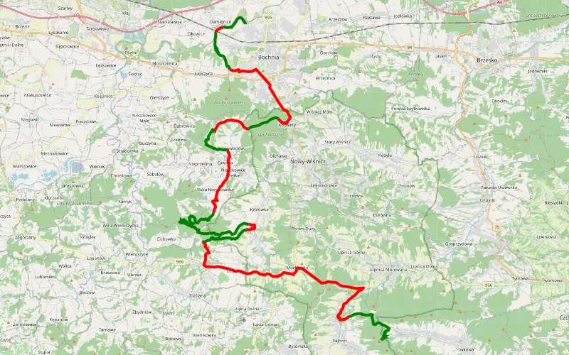
45% Offroad score
Moderate
450m Highest peak
Jelen
Offroad score45%
No known restrictions99%
Distance53.42 km
Highest peak450m
Offroad23.78 km
8 years ago
View route
46% Offroad score
Moderate
222m Highest peak
Davrowka i okolice
Offroad score46%
No known restrictions97%
Distance20.76 km
Highest peak222m
Offroad9.65 km
8 years ago
View route
31% Offroad score
Easy
372m Highest peak
Pilzno - Ostrów Królewski
Offroad score31%
No known restrictions95%
Distance84.64 km
Highest peak372m
Offroad26.38 km
4 years ago
View route
53% Offroad score
Moderate
515m Highest peak
Bochnia-lipnica
Offroad score53%
No known restrictions93%
Distance72.56 km
Highest peak515m
Offroad38.41 km
6 years ago
View route
12% Offroad score
Easy
732m Highest peak
Damienice - Podborze
Offroad score12%
No known restrictions82%
Distance306.4 km
Highest peak732m
Offroad36.46 km
3 years ago
View route