



Routes
Radzyń Podlaski County/ Lublin Voivodeship
Showing 18 routes

50% Offroad score
Moderate
159m Highest peak
Biała - Brzeziny
Offroad score50%
No known restrictions99%
Distance48.31 km
Highest peak159m
Offroad24.13 km
1 year ago
View route
53% Offroad score
Moderate
183m Highest peak
Kobiałki Stare - Poważe
Offroad score53%
No known restrictions97%
Distance62.65 km
Highest peak183m
Offroad33.17 km
1 year ago
View route
71% Offroad score
Difficult
160m Highest peak
Szaniawy Matysy - Szaniawy
Offroad score71%
No known restrictions97%
Distance12.2 km
Highest peak160m
Offroad8.66 km
8 months ago
View route
85% Offroad score
Difficult
162m Highest peak
Nurzyna - Radzyń Podlaski 90% szutry
Offroad score85%
No known restrictions83%
Distance18.62 km
Highest peak162m
Offroad15.78 km
8 months ago
View route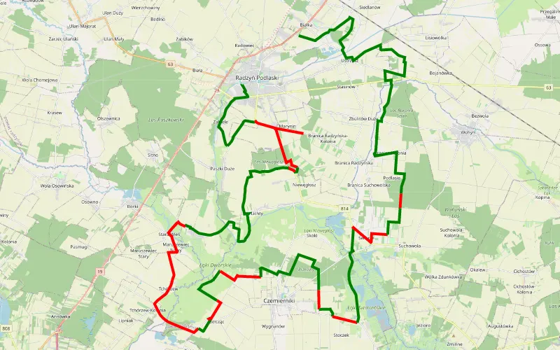
57% Offroad score
Moderate
163m Highest peak
Offroad wokół Radzynia
Offroad score57%
No known restrictions99%
Distance61.64 km
Highest peak163m
Offroad35.04 km
4 days ago1
View route
83% Offroad score
Difficult
173m Highest peak
Kolonia Pasmugi - Wojcieszków
Offroad score83%
No known restrictions56%
Distance14.06 km
Highest peak173m
Offroad11.74 km
7 months ago
View route
61% Offroad score
Moderate
161m Highest peak
radzyń-szczekarów
Offroad score61%
No known restrictions98%
Distance47.13 km
Highest peak161m
Offroad28.86 km
4 years ago
View route
48% Offroad score
Moderate
176m Highest peak
Świdry - Skrzyszew
Offroad score48%
No known restrictions96%
Distance50.22 km
Highest peak176m
Offroad24.36 km
4 years ago
View route
80% Offroad score
Difficult
167m Highest peak
Zieleniec - Bezwola
Offroad score80%
No known restrictions93%
Distance11.4 km
Highest peak167m
Offroad9.09 km
4 years ago
View route
53% Offroad score
Moderate
178m Highest peak
Stoczek Łukowski - Poważe
Offroad score53%
No known restrictions98%
Distance64.96 km
Highest peak178m
Offroad34.19 km
4 years ago
View route
25% Offroad score
Easy
179m Highest peak
Ossowa - Bezwola
Offroad score25%
No known restrictions96%
Distance16.48 km
Highest peak179m
Offroad4.18 km
4 years ago
View route
59% Offroad score
Moderate
177m Highest peak
Ossowa - Bezwola
Offroad score59%
No known restrictions60%
Distance16.17 km
Highest peak177m
Offroad9.58 km
4 years ago
View route
80% Offroad score
Difficult
174m Highest peak
Żelizna - Stary Sławacinek
Offroad score80%
No known restrictions0%
Distance12.64 km
Highest peak174m
Offroad10.1 km
2 years ago
View route
74% Offroad score
Difficult
170m Highest peak
Stasinów
Offroad score74%
No known restrictions36%
Distance14.4 km
Highest peak170m
Offroad10.69 km
4 years ago
View route
100% Offroad score
Difficult
169m Highest peak
Kąkolewnica Północna
Offroad score100%
No known restrictions99%
Distance2.38 km
Highest peak169m
Offroad2.38 km
4 years ago
View route
60% Offroad score
Moderate
180m Highest peak
Łuków Adamów
Offroad score60%
No known restrictions89%
Distance61.26 km
Highest peak180m
Offroad36.83 km
5 years ago
View route
100% Offroad score
Difficult
167m Highest peak
Bezwola
Offroad score100%
No known restrictions99%
Distance0.76 km
Highest peak167m
Offroad0.76 km
4 years ago
View route
11% Offroad score
Easy
212m Highest peak
Kołbiel - Krynki 2021 z Damianem
Offroad score11%
No known restrictions94%
Distance466.62 km
Highest peak212m
Offroad49.12 km
5 years ago
View route