



Routes
Opoczno County/ Łódź Voivodeship
Showing 24 routes

71% Offroad score
Difficult
218m Highest peak
RTO Karolinów
Offroad score71%
No known restrictions83%
Distance23.52 km
Highest peak218m
Offroad16.72 km
3 years ago
View route
56% Offroad score
Moderate
325m Highest peak
Borkowice - Gielniów
Offroad score56%
No known restrictions81%
Distance54.71 km
Highest peak325m
Offroad30.86 km
2 years ago
View route
41% Offroad score
Moderate
211m Highest peak
Dalków - Kościół pw św Wacława - Retkinia Zachód-Smulsko
Offroad score41%
No known restrictions83%
Distance21.74 km
Highest peak211m
Offroad8.87 km
1 year ago
View route
63% Offroad score
Moderate
190m Highest peak
Taraska
Offroad score63%
No known restrictions81%
Distance29.77 km
Highest peak190m
Offroad18.76 km
3 years ago
View route
75% Offroad score
Difficult
205m Highest peak
A
Offroad score75%
No known restrictions81%
Distance32.78 km
Highest peak205m
Offroad24.51 km
4 years ago
View route
39% Offroad score
Easy
158m Highest peak
Myślakowice - Roszkowa Wola
Offroad score39%
No known restrictions94%
Distance24 km
Highest peak158m
Offroad9.43 km
4 years ago
View route
100% Offroad score
Difficult
252m Highest peak
Las Mniszkow
Offroad score100%
No known restrictions58%
Distance7.33 km
Highest peak252m
Offroad7.33 km
1 year ago
View route
33% Offroad score
Easy
214m Highest peak
Łokietka - Januszewice
Offroad score33%
No known restrictions88%
Distance15.83 km
Highest peak214m
Offroad5.3 km
3 years ago
View route
51% Offroad score
Moderate
222m Highest peak
Łęgonice - Ossa
Offroad score51%
No known restrictions87%
Distance81.35 km
Highest peak222m
Offroad41.77 km
1 year ago
View route
42% Offroad score
Moderate
216m Highest peak
28.01 km Offroad Trail
Offroad score42%
No known restrictions81%
Distance28.01 km
Highest peak216m
Offroad11.75 km
4 years ago
View route
78% Offroad score
Difficult
207m Highest peak
Sulejów - kopalnia Mariampol
Offroad score78%
No known restrictions67%
Distance27.18 km
Highest peak207m
Offroad21.13 km
5 years ago
View route
48% Offroad score
Moderate
214m Highest peak
Tomaszów Mazowiecki - Karolinów
Offroad score48%
No known restrictions76%
Distance16.44 km
Highest peak214m
Offroad7.95 km
3 years ago
View route
27% Offroad score
Easy
254m Highest peak
Wojciechów - Kościół pw św Wacława - Niwka
Offroad score27%
No known restrictions81%
Distance59.07 km
Highest peak254m
Offroad15.8 km
1 year ago
View route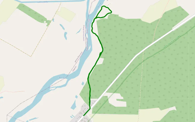
100% Offroad score
Difficult
146m Highest peak
Gapinin
Offroad score100%
No known restrictions97%
Distance2.12 km
Highest peak146m
Offroad2.12 km
22 days ago
View route
60% Offroad score
Moderate
210m Highest peak
Łaznówek - Kowalszczyzna
Offroad score60%
No known restrictions23%
Distance14 km
Highest peak210m
Offroad8.46 km
3 years ago
View route
48% Offroad score
Moderate
253m Highest peak
Smardzewice - Kolonia Popławy
Offroad score48%
No known restrictions73%
Distance21.49 km
Highest peak253m
Offroad10.32 km
4 years ago
View route
72% Offroad score
Difficult
243m Highest peak
Tomaszów Mariampol przez Ciebłowice i Sławno
Offroad score72%
No known restrictions84%
Distance45.94 km
Highest peak243m
Offroad33.07 km
5 years ago
View route
68% Offroad score
Moderate
238m Highest peak
Tomaszów -> Mariampol v1
Offroad score68%
No known restrictions82%
Distance28.33 km
Highest peak238m
Offroad19.21 km
5 years ago
View route
100% Offroad score
Difficult
263m Highest peak
Holendry Grabowskie - Mniszków
Offroad score100%
No known restrictions17%
Distance3.92 km
Highest peak263m
Offroad3.92 km
2 years ago
View route
45% Offroad score
Moderate
244m Highest peak
Twarda - Wąwał
Offroad score45%
No known restrictions82%
Distance43.43 km
Highest peak244m
Offroad19.51 km
5 years ago
View route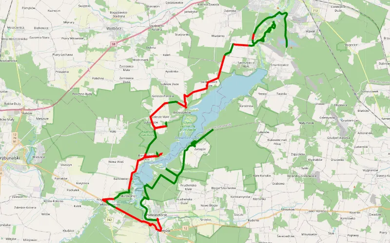
52% Offroad score
Moderate
199m Highest peak
Zarzęcin - Smardzewice niedzielny spacer Suzuki Grand Vitara XL7
Offroad score52%
No known restrictions75%
Distance57.2 km
Highest peak199m
Offroad29.66 km
20 hours ago
View route
59% Offroad score
Moderate
247m Highest peak
Starzyce - Smardzewice
Offroad score59%
No known restrictions66%
Distance45.58 km
Highest peak247m
Offroad26.78 km
5 years ago
View route
46% Offroad score
Moderate
247m Highest peak
Wkoło komina
Offroad score46%
No known restrictions72%
Distance46.43 km
Highest peak247m
Offroad21.14 km
5 years ago
View route
45% Offroad score
Moderate
178m Highest peak
Kobuz - Mysiakowiec
Offroad score45%
No known restrictions95%
Distance29.39 km
Highest peak178m
Offroad13.19 km
7 years ago
View route